General
Call For Participation-AARSE2016 Conference Kampala

General
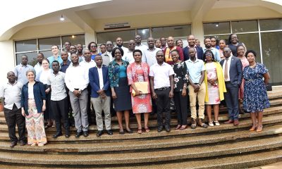
Hands-On RIMS Training Equips Makerere University College Registrars to Power Graduate Success and Research Excellence
By Moses Lutaaya
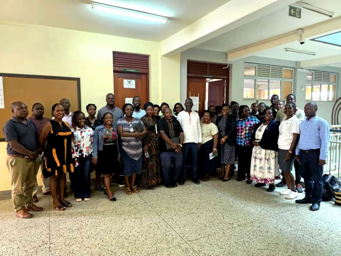
Kampala, April 10, 2026 — College Registrars and Senior IT Technicians at Makerere University have undergone intensive, hands-on training in the Research Information Management System (RIMS), in a move aimed at strengthening graduate training, improving completion rates, and advancing the university’s research agenda.
The training, held on Friday at the CFT 2 Building, Lecture Room 4.1 Computer Lab, brought together key custodians of academic records to gain practical skills in using the system that university leadership says will transform graduate education management.
In his opening remarks, the Director of Graduate Training, Julius Kikooma, underscored the strategic importance of RIMS, linking it directly to the university’s long-standing challenges in tracking graduate students and supporting research progression.
“Graduate training is central to the research mission of this university,” Prof. Kikooma told participants. “Yet for years, we have struggled to answer simple but critical questions, where exactly are our graduate students in their academic journey, and why are many not completing on time?”
He pointed out that the issue has consistently drawn concern from top university leadership, including Council, particularly as Makerere rolls out its new five-year strategic plan. “One of the key priorities identified is improving graduate completion rates,” he said. “But we cannot improve what we cannot measure.”
Prof. Kikooma explained that unlike undergraduate programmes, graduate studies are largely research-driven and therefore more complex to monitor. “The research component of graduate programmes has not been adequately captured in any system,” he noted. “That is why it has been difficult to track progress, supervise effectively, and provide accurate reports.”
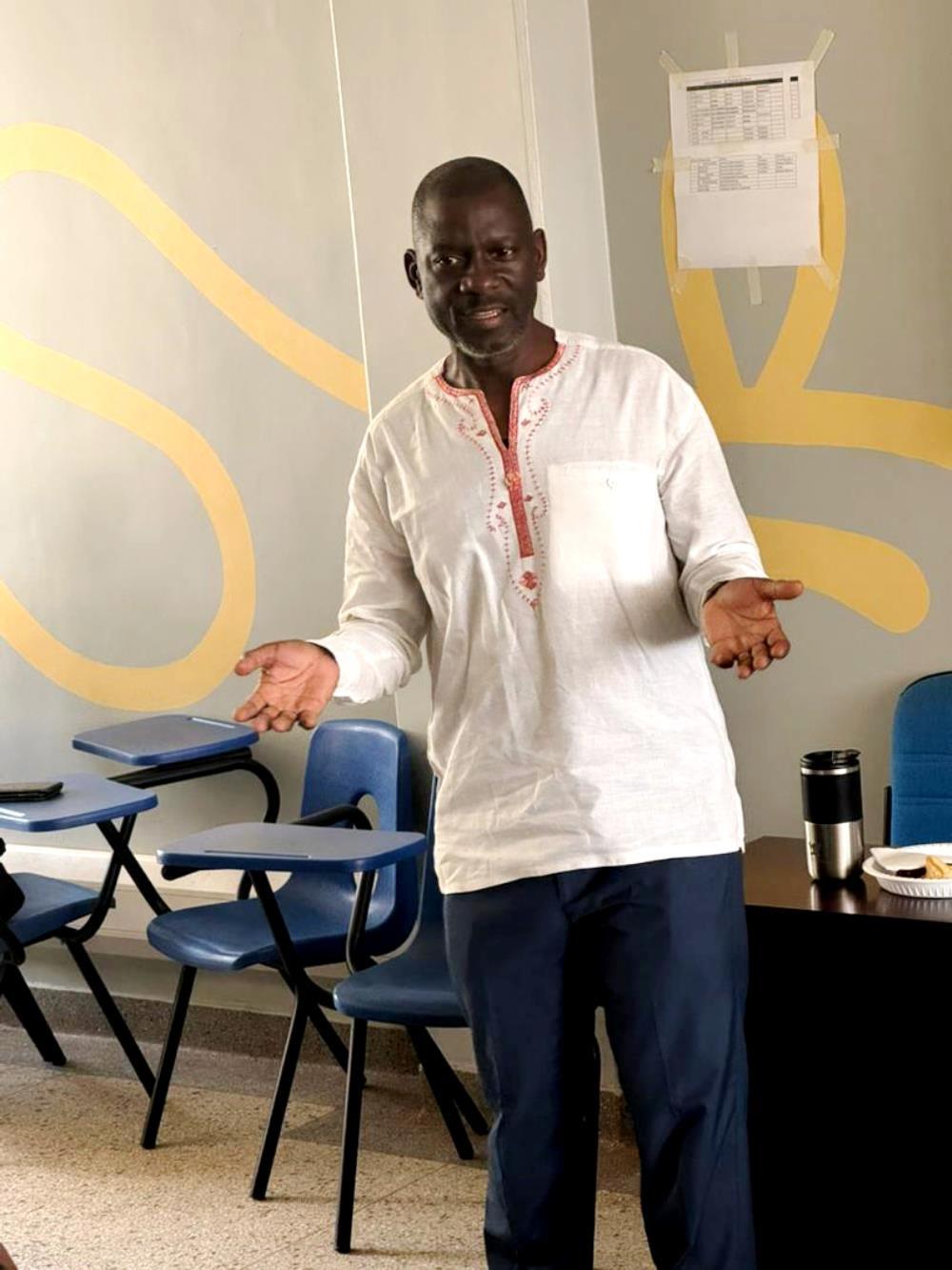
Positioning RIMS as a transformative solution, he emphasized its role in bridging this gap. “RIMS is not just a system, it is the backbone of how we are going to support graduate students and research going forward,” he said. “With it, we can track every stage, from concept development to proposal, to thesis completion in real time.”
He stressed that the system will enhance both efficiency and accountability across the university. “This is the tool that will enable us to confidently assure Council and management that we know the status of every graduate student at any given time,” he said.
However, Prof. Kikooma made it clear that the success of RIMS depends heavily on the commitment of college registrars. “You are the custodians of graduate records. You are central to this process,” he said. “If RIMS succeeds, it will be because of your efforts. If it fails, it will be because you did not play your part.”
He revealed that registrars will now form part of the steering committees overseeing the full implementation of RIMS across university units. “You are not just users of this system, you are its drivers at the college level,” he emphasized.
Calling for seriousness and full participation, Prof. Kikooma set clear expectations for the training. “No one should leave this room without knowing how to use RIMS in their daily work,” he said. “You must understand the kind of data required, the information on students, supervisors, and every stage of the research process.”
He added that incomplete data has already limited the system’s effectiveness in some units. “Graduate students are already on the system, but some of the critical information is missing,” he noted. “That gap must be closed by you.”
In his technical presentation, Juma Katongole, the Manager Information Systems, highlighted the limitations of existing systems and how RIMS is designed to address them.
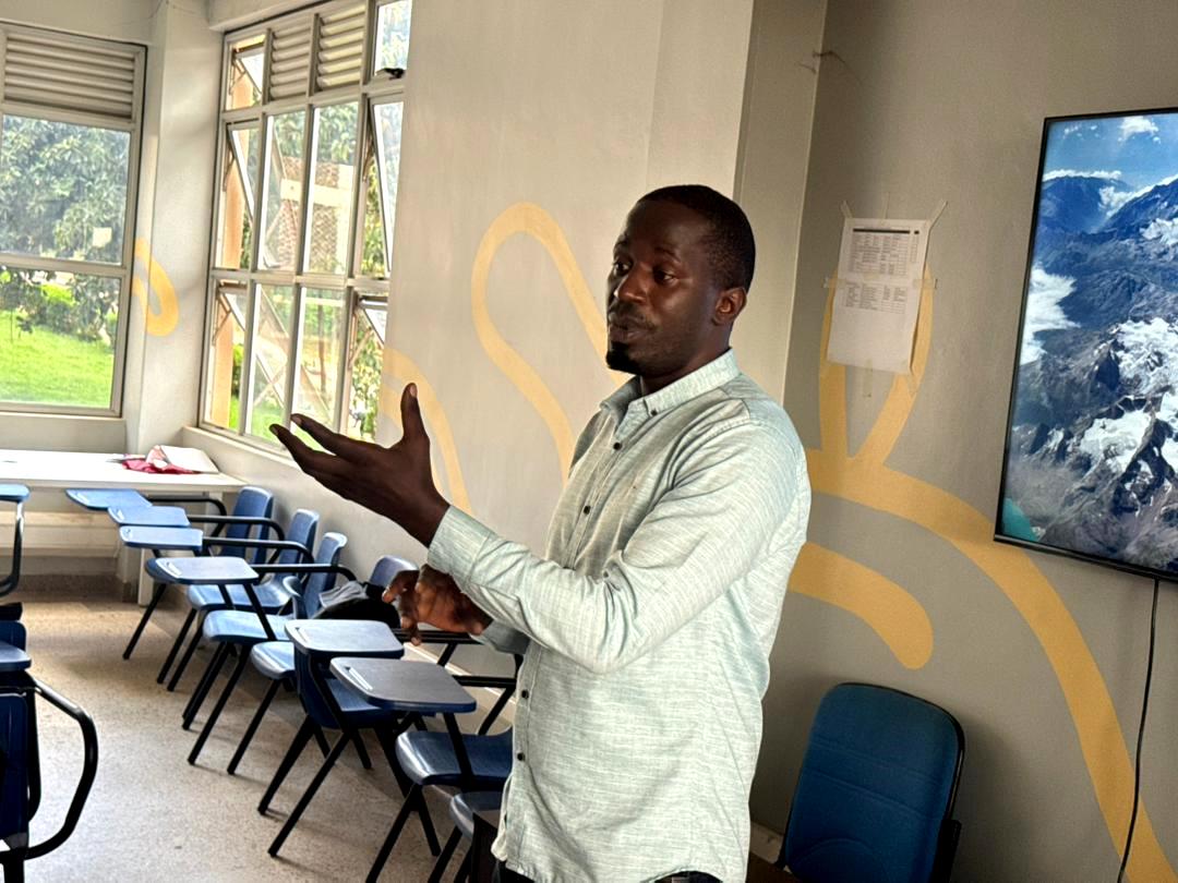
“We can only produce accurate statistics for students on coursework,” he said. “But we cannot tell how many graduate students are at proposal level, concept level, or thesis level. That is a major gap.”
He explained that RIMS will provide comprehensive, real-time tracking of graduate students throughout their academic journey. “This system will enable us to produce accurate reports of which student is where,” Katongole said. “It will help us identify delays and take action.”
On the issue of prolonged completion times, he added, “With reliable data, we can see where students are getting stuck and introduce administrative or strategic measures to address those bottlenecks.”
Describing the system as a turning point, Katongole noted, “We are moving towards having valid statistical information at our fingertips, which is critical for a research-led institution.”
From the administrative perspective, Eleanor Nandutu, Senior Assistant Registrar from MISR, welcomed the initiative, describing it as a practical solution to long-standing inefficiencies.
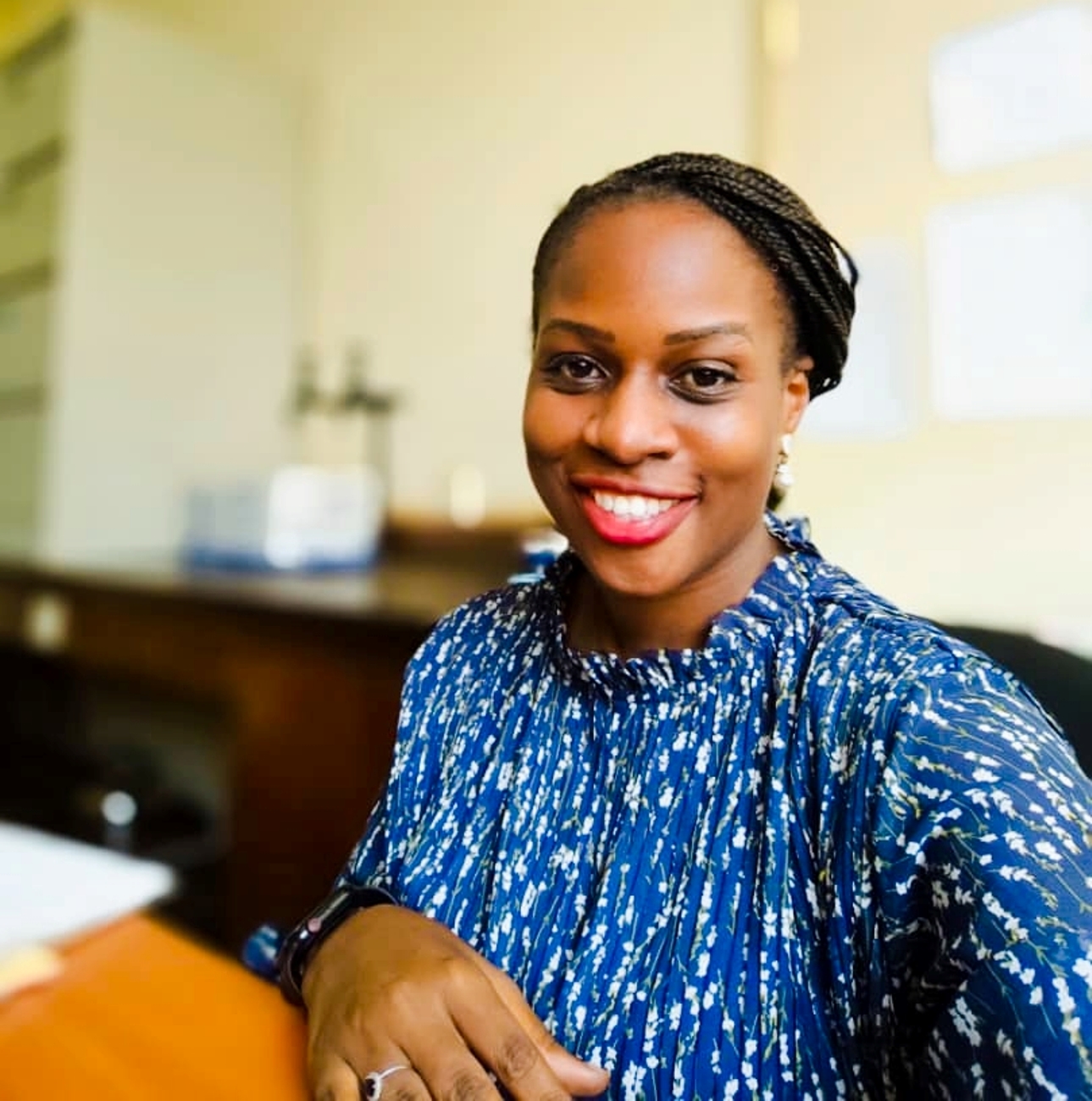
“RIMS will ease the tracking process and help us know exactly where each student is and how long they take at each stage,” she said. “It will also help us understand where the challenges are and how to better support students.”
She emphasized that the system will improve completion rates by identifying bottlenecks early. “We shall be able to see where we are stuck and take corrective action in time,” she noted.
Addressing concerns about possible conflict of interest between supervisors and students, Nandutu clarified that the system is designed to enhance transparency, not create tension. “This is about ensuring that processes are followed and that students succeed,” she said. “It brings everyone, administrators, supervisors, and coordinators onto one platform.”
She added that the system will even improve interaction between students and supervisors. “It will make follow-ups easier and ensure timely feedback, which is critical for research progress,” she said.
As the university intensifies efforts to strengthen its research output and graduate training, the hands-on RIMS training marks a significant step toward a more efficient, transparent, and data-driven academic environment, one that leaders believe will finally address the long-standing challenge of delayed graduate completion.
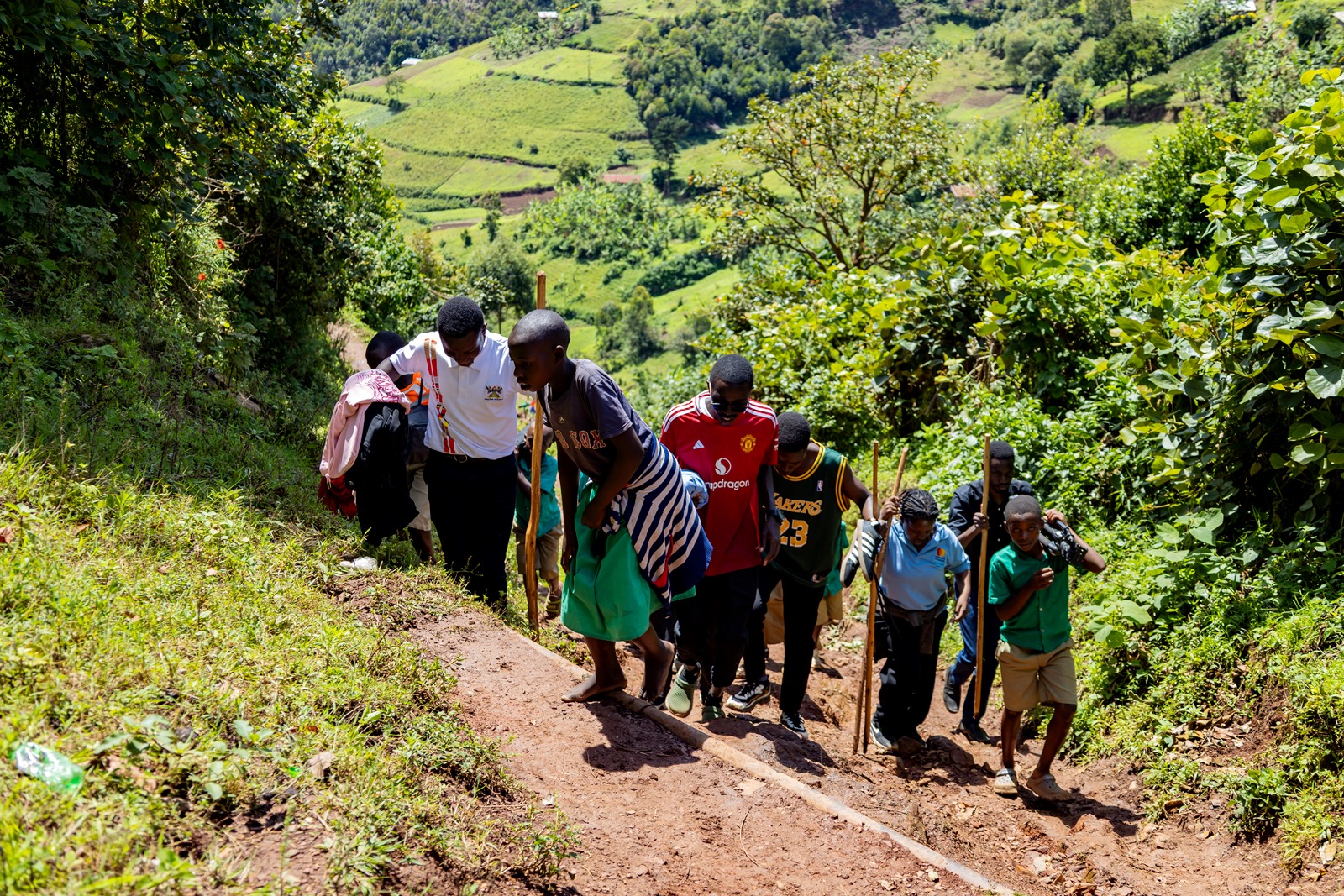
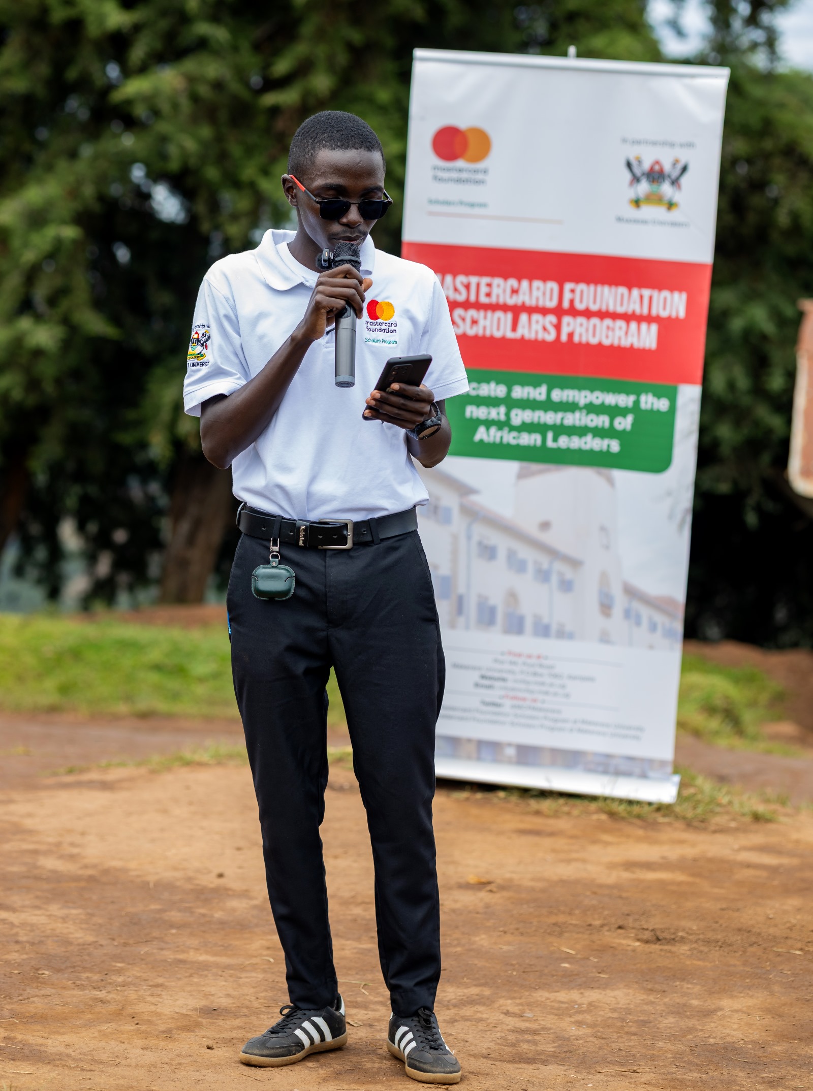
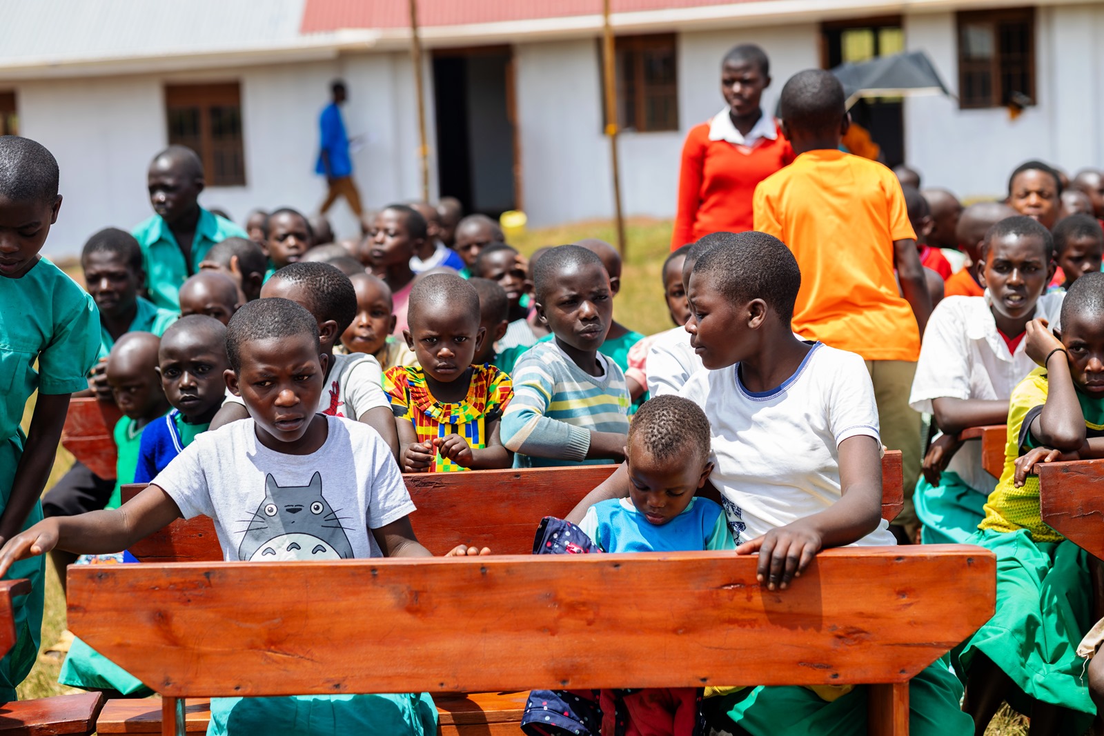
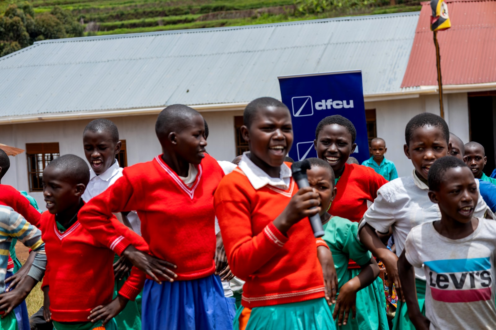
Pupils, parents and authorities at Bwera Primary School in Kabale District were filled with joy as the Mastercard Foundation Scholars Program at Makerere University, in partnership with dfcu Bank, handed over a four-classroom block to the school.
Speaking during the commissioning ceremony, one of the parents, Saison Tumukuratire, expressed gratitude for the support.
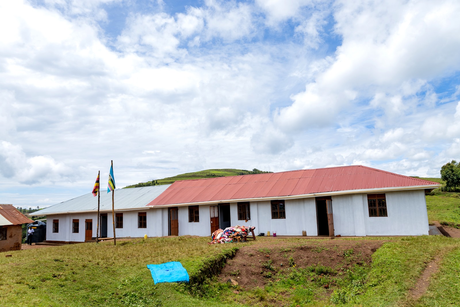
“We thank God for this gesture. Our children can now attend classes without interruptions caused by rain. Previously, whenever it rained, lessons would stop. The old building was on the verge of collapsing, had no windows, and the floor was dusty,” she said.
Uganda has made significant progress in expanding access to education through Universal Primary Education (UPE); bringing millions of children into school. However, in hard-to-reach communities, physical access and the quality of learning environments continue to shape how effectively that opportunity translates into consistent attendance and meaningful outcomes.
Bwera Primary School, a government-aided institution located in the remote and hard to reach village in Kahama Sub-County, has an enrollment of 275 pupils. For decades, the school has faced significant challenges related to access and infrastructure.
With no road access and limited infrastructure, the school has long struggled to provide a conducive environment for learning. Efforts to improve facilities have often been constrained by high transportation costs and logistical barriers; with some contractors previously declining to take on construction work due to the difficulty of accessing the site.
“The school structures are not sufficient for our learners, and we do not have a single staff house. We are deeply grateful to the Mastercard Foundation Scholars Program and dfcu Bank for coming to our rescue after the school’s plight was highlighted in the media,” Edson Bikorwomuhangi, the headteacher, said.
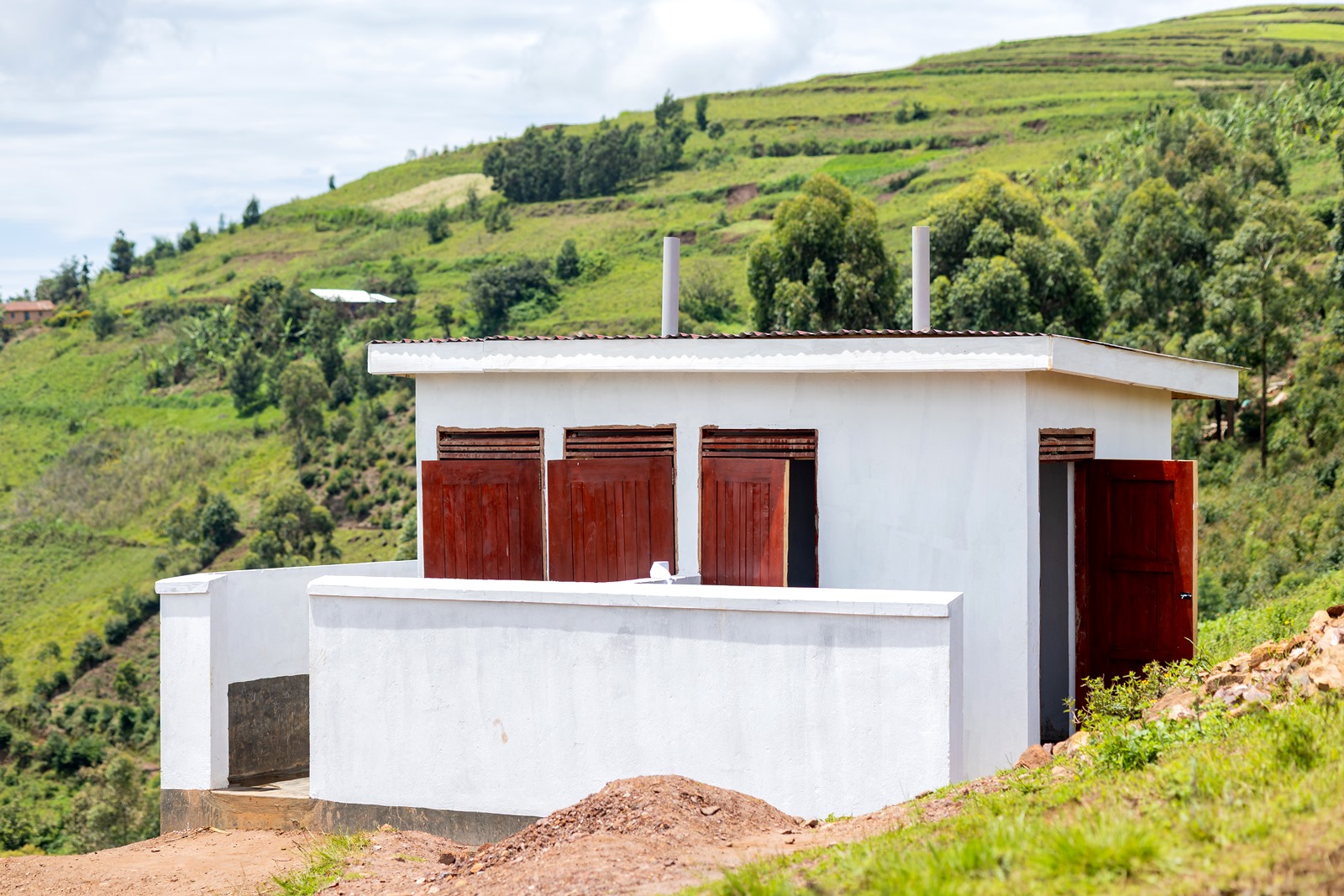
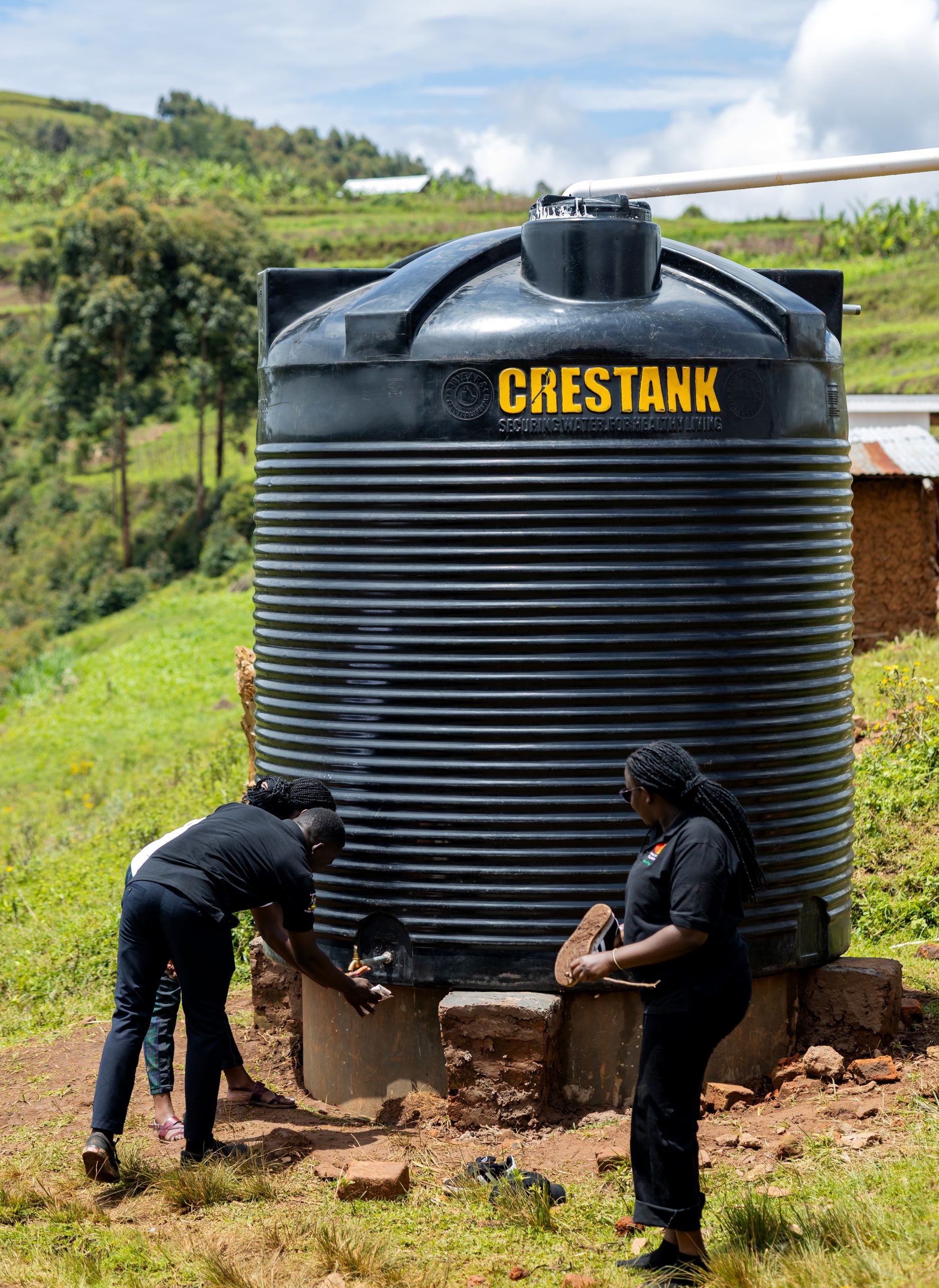
On Wednesday, April 1, 2026, the Mastercard Foundation Scholars Program at Makerere University and dfcu Bank officially handed over the new facilities. These include a four-classroom block equipped with 60 bench desks, a four-stance modern pit latrine, and a 10,000-litre rainwater harvesting system.
The new infrastructure is expected to significantly improve the learning environment and support better educational outcomes for the pupils.
Since 2014, Mastercard Foundation Scholars at Makerere University and alumni have contributed to communities across Uganda by constructing classrooms, providing clean water and supporting vulnerable communities.
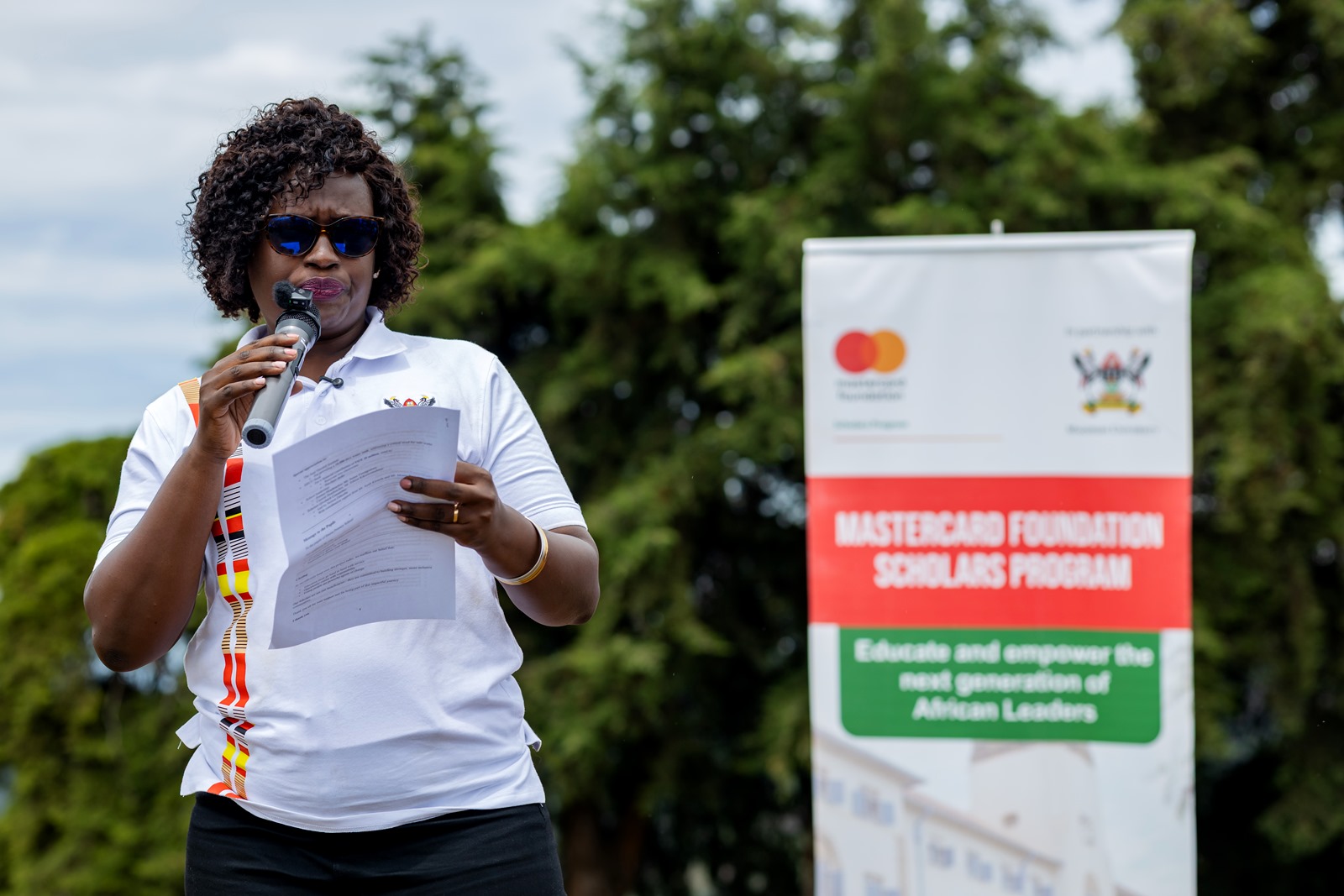
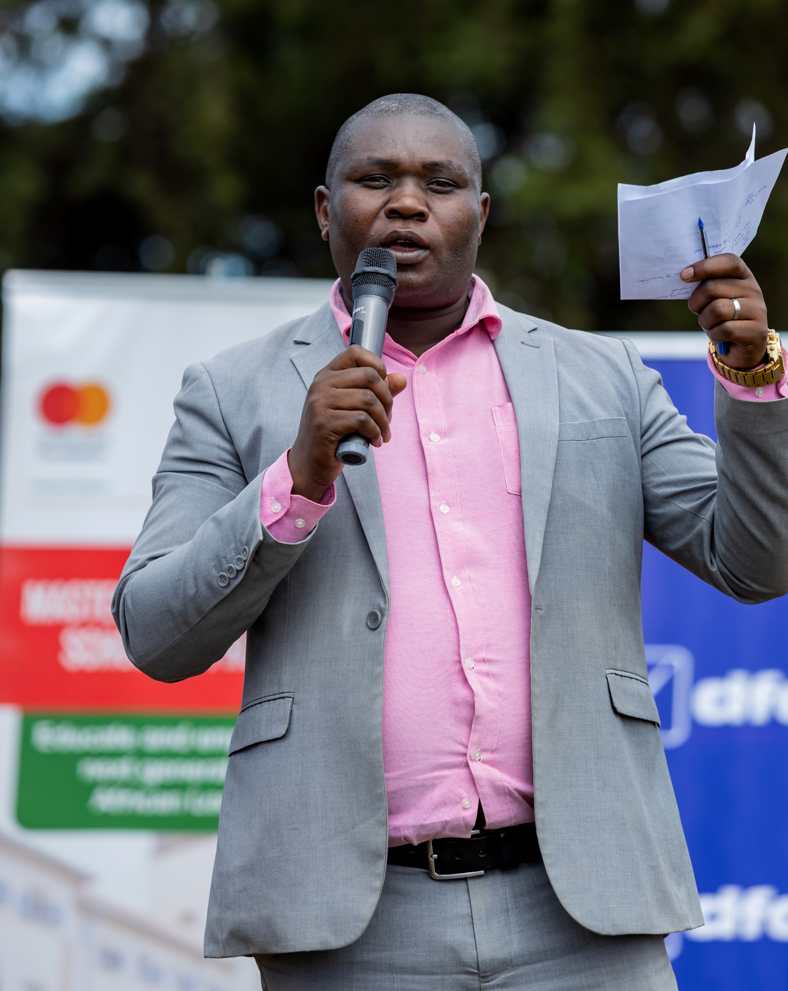
Speaking at the event, Mr. Nelson Dumba, the Chairperson of the Scholars giveback Committee, noted that the event was not about commissioning structures, it is about celebrating impact, partnership and the power of giving back.
“As scholars we are deeply aware that we are beneficiaries of opportunity, and because we have been given a chance, we carry a responsibility to extend that opportunity to others and contribute meaningfully to the communities that shape us,” Mr. Dumba, said.
Mr. Dumba called upon the Bwera community to take ownership, protect the property, and ensure that it continues to serve generations to come.
“To the pupils of Bwera Primary, this investment is for you, use it well, take care of it and believe in your dreams. You are capable of achieving better outcomes,” Mr. Ddumba, said.
One of the central pillar of the Scholars Program is community service and giveback, grounded in the belief that leadership is best demonstrated through service to others.The Scholars Program is not only about access to education, it is about transformation and impact.
In her speech, Ms. Jolly Okumu, the Program Operation Lead of the Mastercard Foundation Scholars Program at Makerere University, noted that through mentorship and structured engagement, Mastercard Foundation Scholars are encouraged to initiate community-driven projects, improve livelihoods, promote inclusion and foster sustainable development.
“Today is not just about handing over infrastructure, it is a celebration of partnership, shared purpose and our collective commitment to improving learning environment for young people. It reflects our belief that when institutions and communities come together, we can create lasting impact and open up greater possibilities for the next generation,” Ms Okumu, said.
Ms Okumu extended special appreciation to the Jane Goodall Institute for providing a 10,000 litre water tank and dfcu Bank for a financial contribution of UGX 20Million used to renovate two classrooms and purchase desks.
“As we officially hand over this project, we hope these improved facilities will provide a safe environment and a space conducive for learning. Our Scholars are not just beneficiaries, they are committed to building a stronger and more inclusive communities,” Ms. Okumu, noted.
Speaking on behalf of dfcu Bank, Ms Helena Mayanja, the Head of Corporate Affairs and Sustainability, noted that the giveback project reflects the Bank’s commitment to elevate education, financial literacy and health in intended communities.
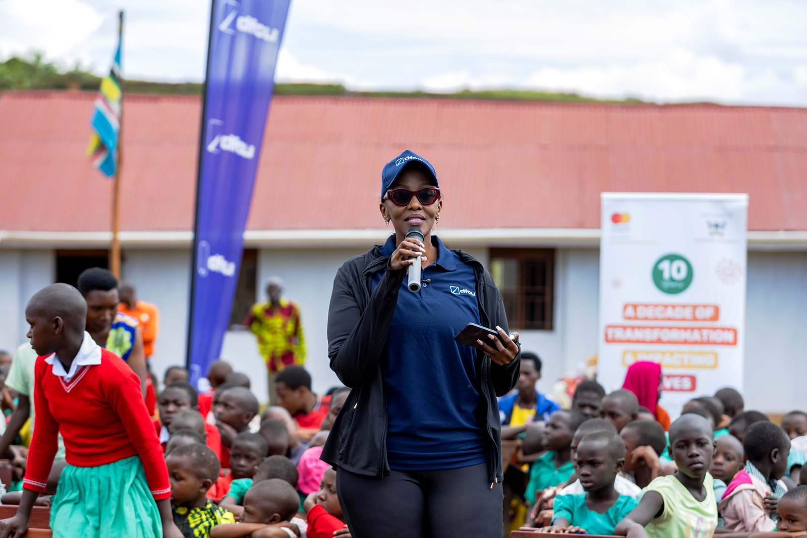
“The journey to the school itself reflects the realities these children face every day. Improving infrastructure in such communities is essential to ensuring that access to education translates into real learning outcomes,” she said.
dfcu Bank has various partnerships and programs targeting vulnerable and hard to reach communities which are aimed at elevating financial literacy, health and education.
Kabale District Education Officer, Mr. Moses Tumwijukye Bwengye welcomed the development, noting that previous efforts to upgrade the school had failed due to inaccessibility.
“We thank our partners for renovating this classroom, with these projects, results are going to change because now the learning is conducive. Before contractors were unable to take on the work because of the terrain. Partnerships like this are important in unlocking development in hard-to-reach communities and improving education outcomes,” Mr. Tumwijukye, said.
Parents speak out
Evidence Tumwebaza, who has a child in Primary One noted that the infrastructures are going to help them improve the school’s sanitation.
“The tank is big and I am happy that my child will now study in a conducive environment and will have clean water for drinking,” Tumwebaza, said.
Ann Turyasima, a parent and former pupil said that the project is going to help pupils to stop carrying water from a long distance.
“These pupils have been moving from down the valley to go and fetch water for the school but now everything is here. They can now concentrate in school.”
-

 General2 weeks ago
Application for Admission to Graduate Programmes 2026/27
-
 General1 week ago
Mastercard Foundation Scholars Program at Makerere University Celebrates the Last Cohort of Phase One Graduates
-
 Agriculture & Environment1 week ago
CPUg Project Equips Waste Management Personnel with Essential Skills
-

 Veterinary & Biosecurity2 weeks ago
From Classroom to Cattle Farms: Makerere Unleashes 100+ Job Creators in Bold Skills Revolution
-
 Health2 weeks ago
Mak Transitions $100 Million Digital Health Systems Assets to Health Ministry